File:Yukon River Basin USGS.jpg
Jump to navigation
Jump to search
No higher resolution available.
Yukon_River_Basin_USGS.jpg (745 × 511 pixels, file size: 47 KB, MIME type: image/jpeg)
Captions
Captions
Add a one-line explanation of what this file represents
Summary[edit]
| Description |
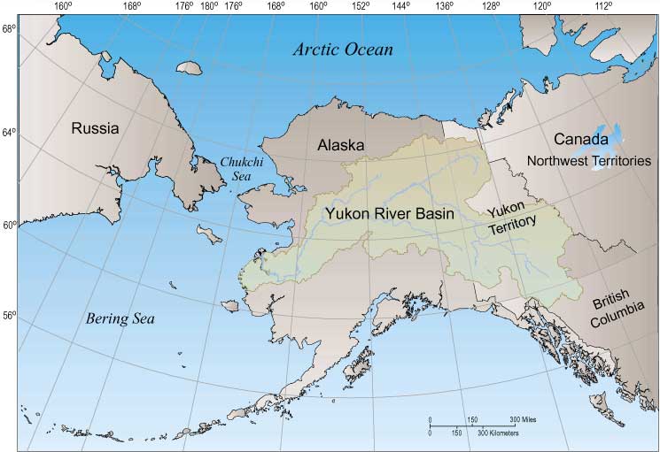
English: Map of the Yukon River Basin — in Alaska and Canada.
Deutsch: Einzugsgebiet des Yukon
Français : Le bassin de la rivière Yukon |
| Source | usgs.gov |
| Author | USGS |
See also[edit]


Licensing[edit]
This image is in the public domain in the United States because it only contains materials that originally came from the United States Geological Survey, an agency of the United States Department of the Interior. For more information, see the official USGS copyright policy.
|
File history
Click on a date/time to view the file as it appeared at that time.
| Date/Time | Thumbnail | Dimensions | User | Comment | |
|---|---|---|---|---|---|
| current | 12:35, 29 May 2008 | | 745 × 511 (47 KB) | Aconcagua (talk | contribs) | {{Information |Description={{en|1=Yukon River Basin}} {{de|1=Einzugsgebiet des Yukon}} |Source=[http://water.usgs.gov/nasqan/progdocs/factsheets/yukonfact/fig1.jpg usgs.gov] |Author=USGS |Date= |Permission= |other_versions= }} ==See also== <gallery> Image |
You cannot overwrite this file.
File usage on Commons
The following 2 pages use this file:
File usage on other wikis
The following other wikis use this file:
- Usage on en.wikipedia.org
- Usage on fr.wikipedia.org
- Usage on io.wikipedia.org
- Usage on ja.wikipedia.org
- Usage on ta.wikipedia.org
- Usage on www.wikidata.org